Mestia (Mest’ia)
 |
Mestia is located in the Svaneti region of Samegrelo-Zemo Svaneti province (mkhare), some 128 km northeast of the regional capital of Zugdidi. Mestia and the adjoining 132 villages form Mestia District (raioni). Its area is 3044 km2; and its population is 9,316 (1,973 in the town itself), according to the 2014 Georgia census. It was granted the status of a townlet (Georgian: daba) in 1968.
Historically and ethnographically, Mestia has always been regarded a chief community of Zemo, or Upper Svaneti province. It was formerly known as Seti (სეტი). The population is mostly Svans, a cultural and linguistic subgroup of the Georgians. Despite its small size, the townlet was an important centre of Georgian culture for centuries and contains a number of medieval monuments, such as churches and forts, included in a list of UNESCO World Heritage Sites.
Mestia is served by the Queen Tamar Airport, which is operated by the state-owned company United Airports of Georgia, since 2010.
Map - Mestia (Mest’ia)
Map


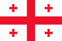
Country - Georgia_(country)
 |
 |
| Flag of Georgia (country) | |
During the classical era, several independent kingdoms became established in what is now Georgia, such as Colchis and Iberia. In the early 4th century, ethnic Georgians officially adopted Christianity, which contributed to the spiritual and political unification of the early Georgian states. In the Middle Ages, the unified Kingdom of Georgia emerged and reached its Golden Age during the reign of King David IV and Queen Tamar in the 12th and early 13th centuries. Thereafter, the kingdom declined and eventually disintegrated under the hegemony of various regional powers, including the Mongols, the Turks, and various dynasties of Persia. In 1783, one of the Georgian kingdoms entered into an alliance with the Russian Empire, which proceeded to annex the territory of modern Georgia in a piecemeal fashion throughout the 19th century.
Currency / Language
| ISO | Currency | Symbol | Significant figures |
|---|---|---|---|
| GEL | Georgian lari | ₾ | 2 |
| ISO | Language |
|---|---|
| HY | Armenian language |
| AZ | Azerbaijani language |
| KA | Georgian language |
| RU | Russian language |